
Six methods that build one picture of the ground
Every engagement is scoped to the question that matters at that stage — regional hazard for site selection, near-surface imaging for foundation design, liquefaction potential for seismic zones.
PSHA / DSHA
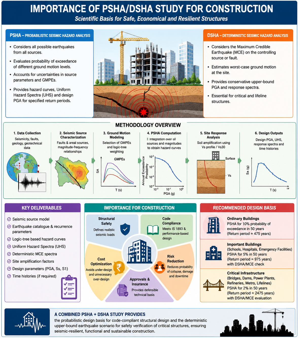
Probabilistic Seismic Hazard Analysis considers all credible earthquake sources and produces hazard curves and Uniform Hazard Spectra for a chosen return period. Deterministic Seismic Hazard Analysis evaluates the Maximum Credible Earthquake on the controlling fault for a conservative, worst-case design basis. Used together, they satisfy IS 1893 design requirements for ordinary buildings through critical infrastructure.
MASW
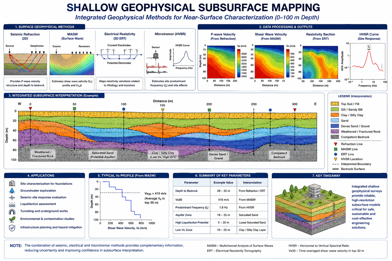
Multichannel Analysis of Surface Waves estimates the shear-wave velocity profile from surface measurements, without boreholes. The resulting Vs30 value determines IS 1893 site class and feeds directly into site response analysis.
ERT
2D Electrical Resistivity Tomography maps subsurface resistivity contrasts tied to lithology, moisture and weathering — useful for identifying aquifers, fill boundaries, and depth to bedrock across a site.
GPR
Ground-Penetrating Radar images shallow subsurface features non-invasively — buried utilities, voids, foundations and fill boundaries — ahead of excavation or intrusive investigation.
Liquefaction assessment
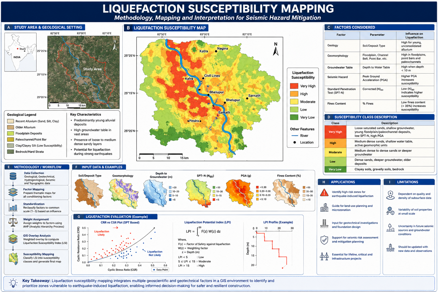
SPT-based comparison of Cyclic Resistance Ratio against Cyclic Stress Ratio establishes liquefaction potential by depth. Results are integrated into a Liquefaction Potential Index (LPI) and mapped across susceptibility classes from very low to very high.
GIS hazard zonation
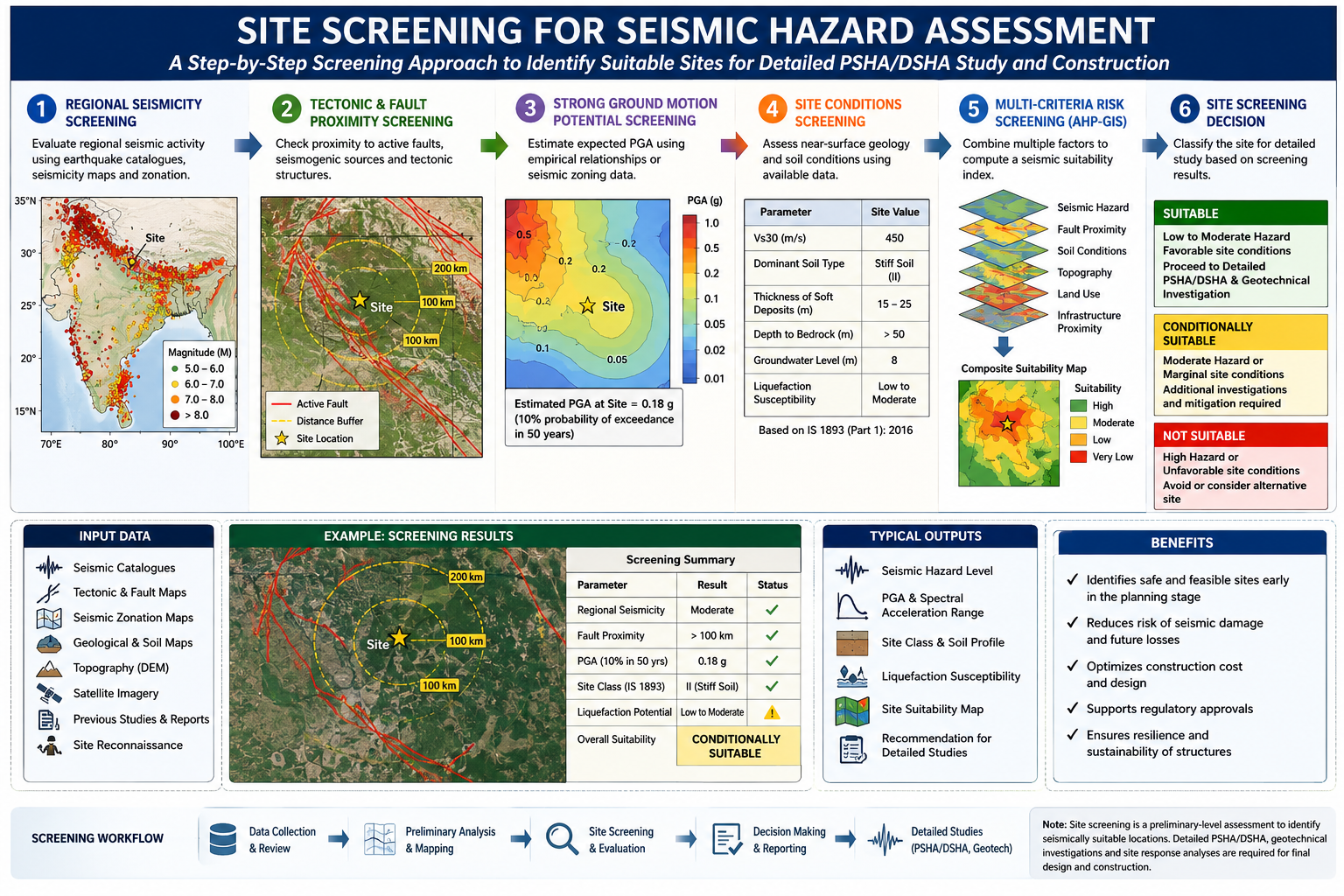
Seismic hazard, fault proximity, soil conditions, topography, land use and infrastructure proximity are standardized, weighted using the Analytic Hierarchy Process, and overlaid in GIS to produce a composite site suitability map.
How each method is applied
The following reference sheets outline our working methodology for the four most-requested assessment types.
Standards and credentialing
A common question we get: which certification do we need before commissioning a survey? Here's the accurate picture.
IS 19235:2025
The relevant geotechnical services standard. It is compliance-based rather than a stamp certification — work is expected to conform to it, not be separately "certified" against it.
NABL accreditation
The correct accreditation pathway for a survey/testing services firm — not BIS. NABL accreditation is the recognized route for demonstrating laboratory and testing competence in India.
GeM registration
Government e-Marketplace registration, enabling participation in government and public-sector procurement for site screening and geotechnical services.
ISO 9001:2015
Quality management system certification — an optional but recognized signal of process maturity for larger EPC and institutional clients.
Note: BIS certifies products, not survey service firms — a common point of confusion when procuring geotechnical services.
Not sure which method fits your site?
Send us the location, structure type and project stage — we'll recommend the right combination.
Talk to us